LandAreas
Find it at the desk.
Prove it in the field.
UK land data, grid capacity and your team’s work on one map. In the browser, on iPhone and on Android™ — with or without signal.
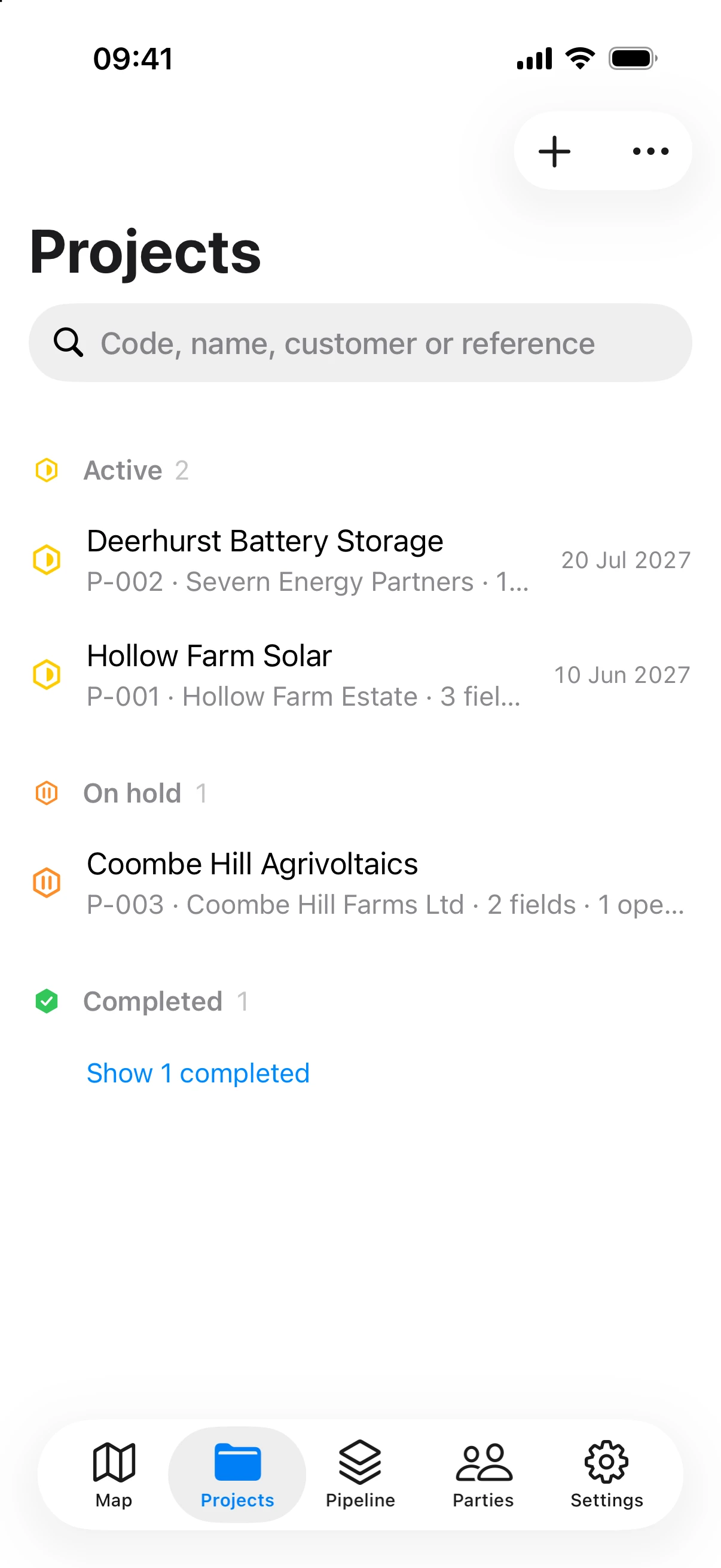
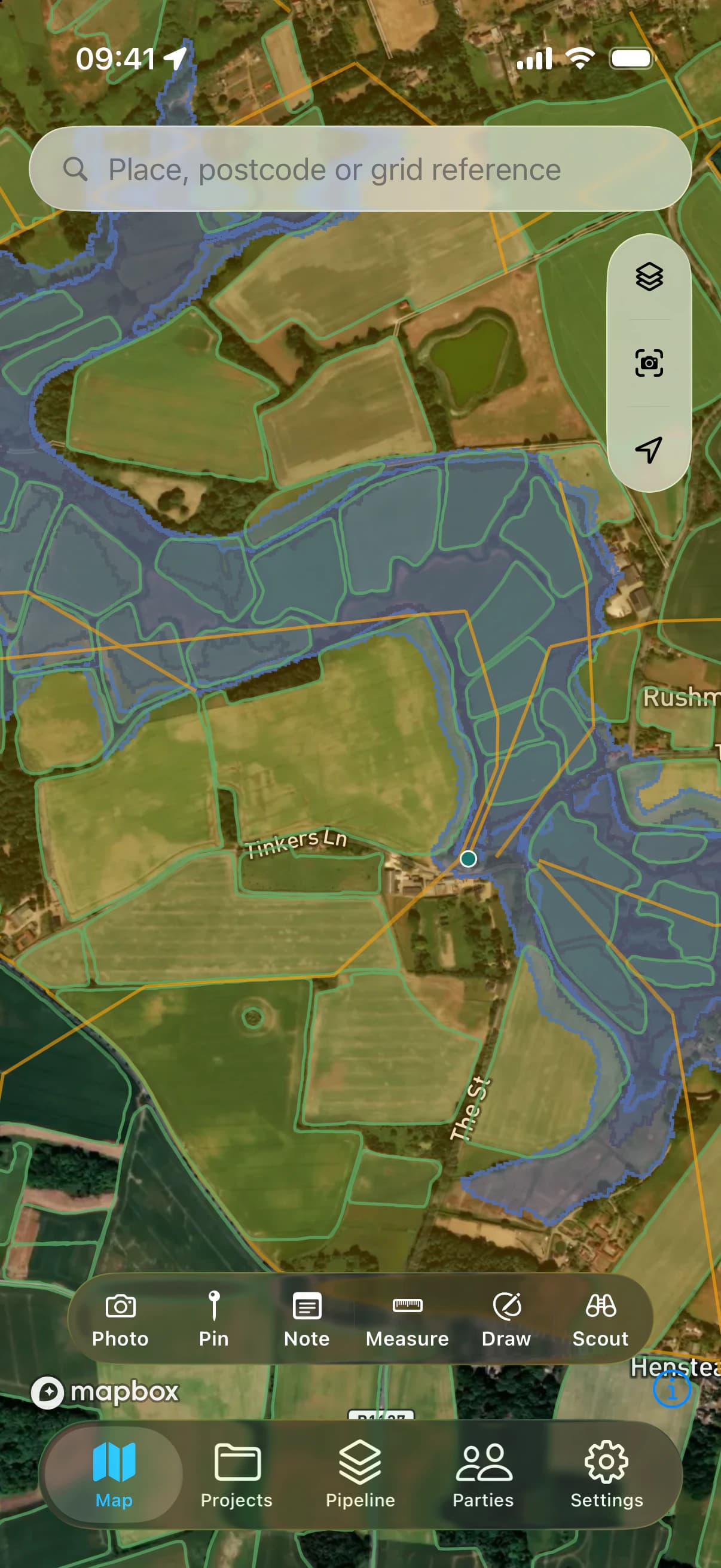
Every site is decided twice. Once on a screen, from the data. Then again in the field, from what is really there. LandAreas is built for both.
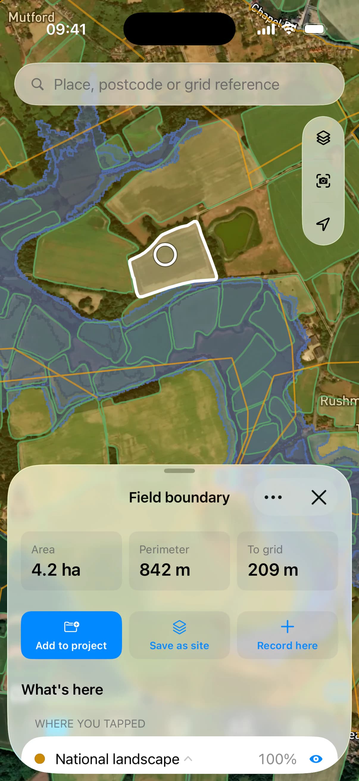
Tap a field.
Know what applies.
LandAreas answers the questions a site is won or lost on, the moment you touch it — and names where every answer came from.
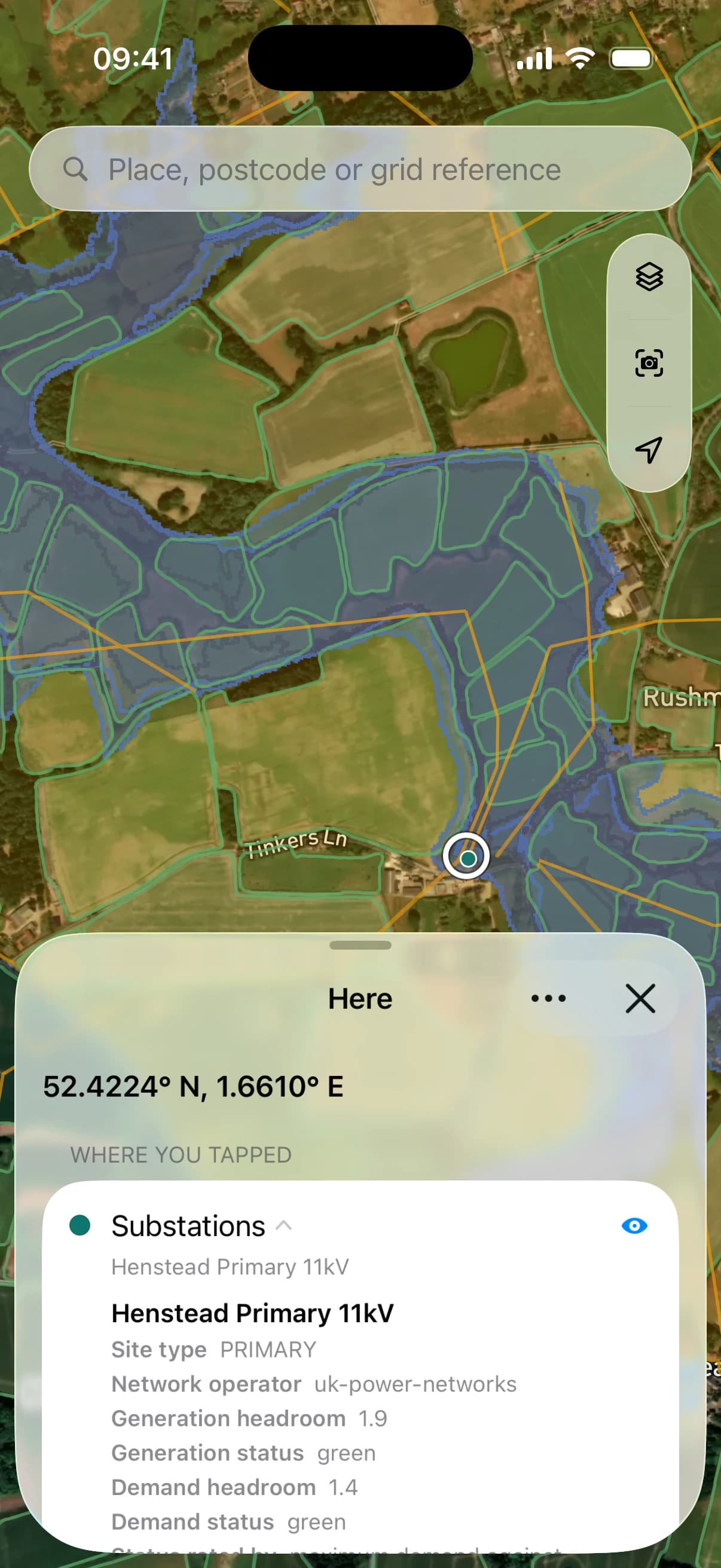
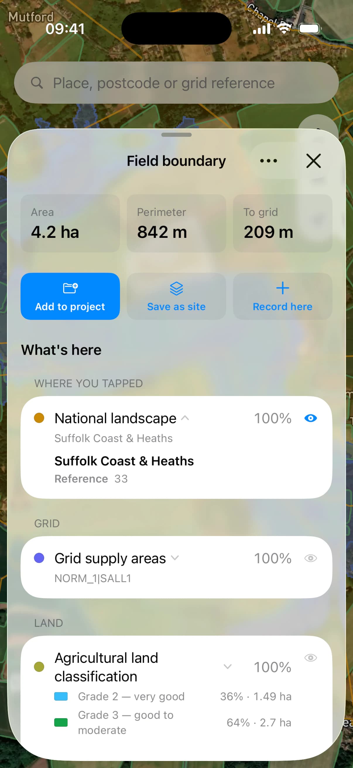
Every constraint, at a glance.
Flood zones, green belt, protected habitats, heritage and land grade — for the field you are looking at, not the whole county.
The grid, next door.
The nearest substations, with the generation and demand headroom their operators publish, and the projects already in planning around them.
Your layers, your way.
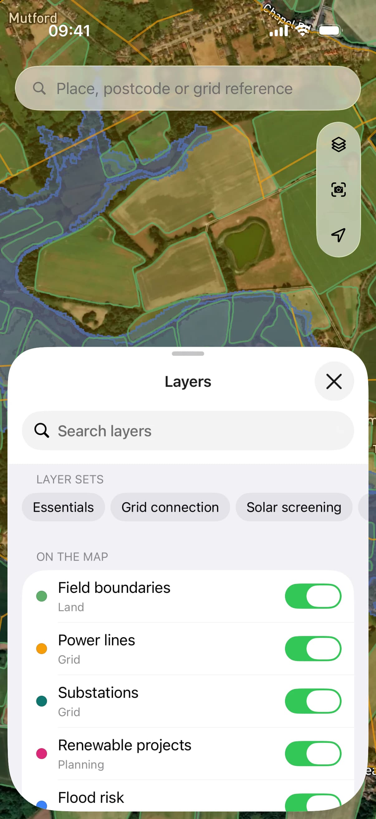
Keep the layers you use together as a set — for grid connection, say, or solar screening — and switch between them with a tap.
300+layers of data. One map.
Planning and policy, flood and ground, nature and heritage, the grid and the renewables already around it — searchable by the names you know them by, stacked as you need them, and a tap away from the field you are on.
The whole team.
One map.
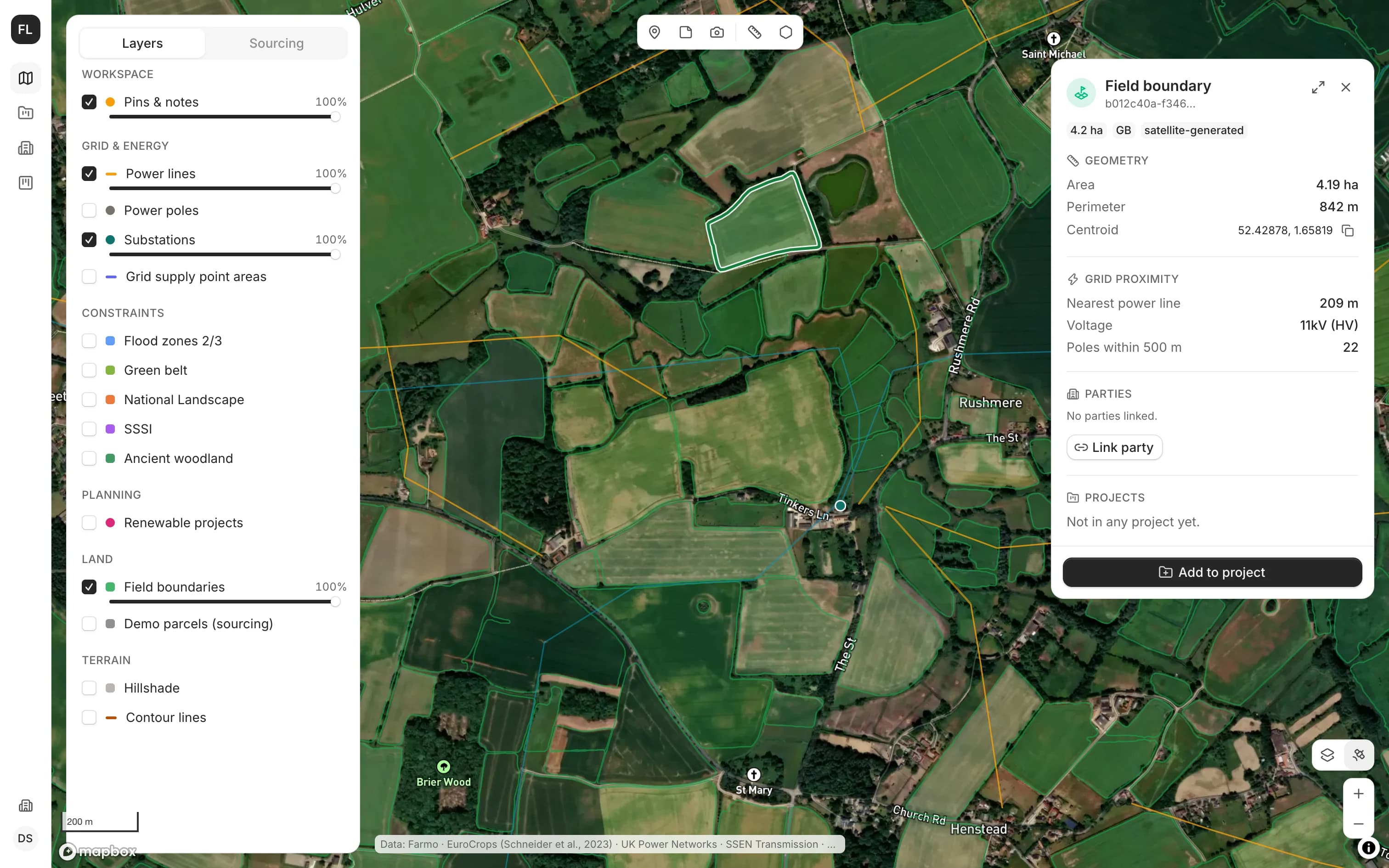
Land managers, planners and the people on site work from the same map and the same pipeline. What one of you finds, all of you see — in the browser at the desk and on the phone in the field.
Start from the grid.
Substations with the headroom their operators publish, the lines between them and the renewable projects already in planning. Find the capacity first, then the land around it.
A pipeline that follows the land.
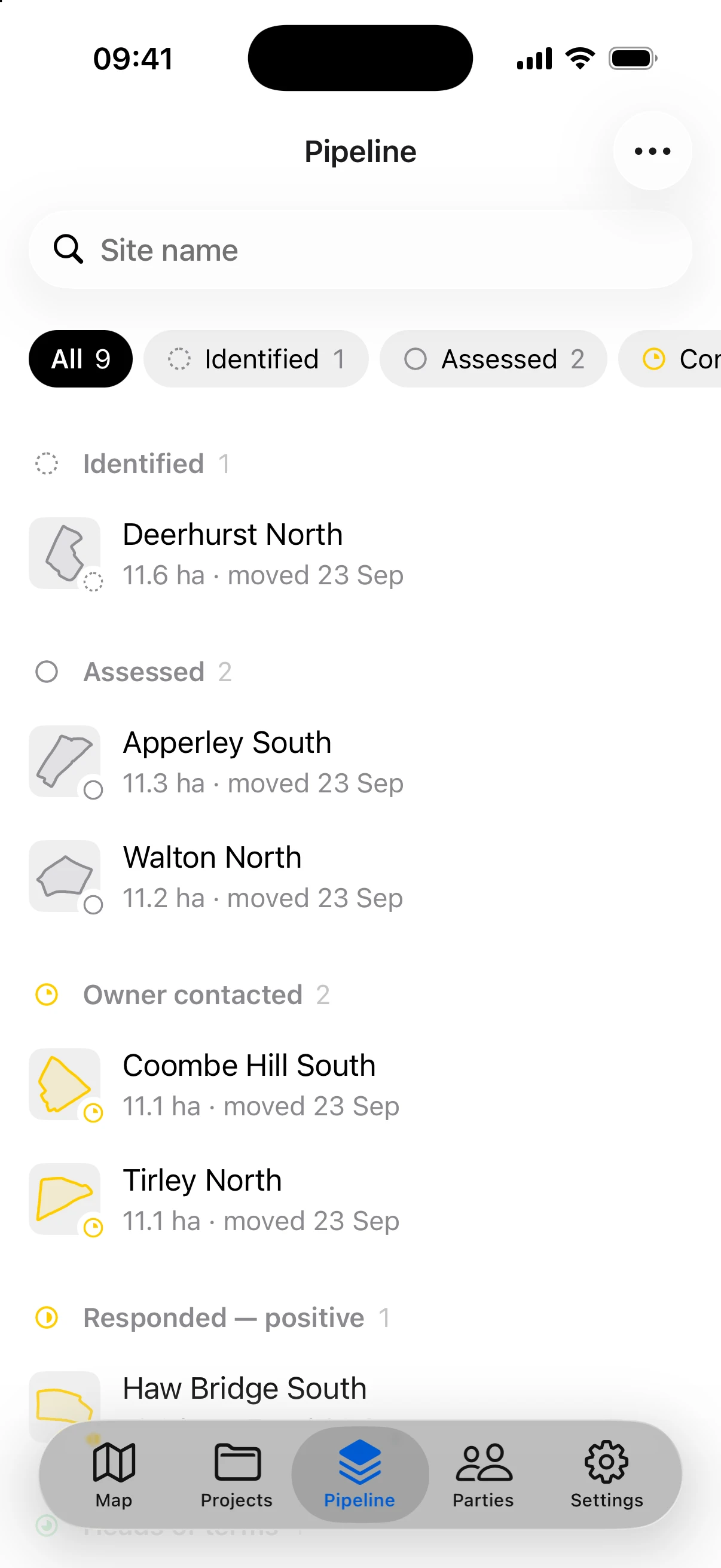
Every site keeps its boundary, its constraints and its history as it moves from identified to secured — with the tasks, people and documents that belong to it.
Field and desk, in step.
What is captured on site reaches the desk as soon as the phone finds a signal, and the desk’s changes reach the phone the same way.
Then go and
stand on it.
LandAreas goes with you to the far end of the farthest field — in the rain, in gloves, with one bar or none.
Works where the signal doesn’t.
Everything you capture is kept on the phone the moment you make it, and reaches the rest of the team as soon as a bar comes back.
Pins, notes and photos, where they happen.
Each keeps the spot it was made, the time and who made it — and a photo, which way it faced — on the map for the whole team.
Photos that know what they show.
The phone reads the signs and pole numbers in a photo, and tells you before you walk away if it came out blurred or crooked.
Look around.
Hold up your iPhone and your pins, notes and the map’s own boundaries stand in the landscape, each with how far it is.
Measure with the camera.
Gate widths, hedge heights and track lengths, measured through the lens on iPhone — with LiDAR on the Pro models.
Take it again.
Stand where a photo was taken, line it up and take it again, then set the two side by side, a season apart.
The project lives
with the land.
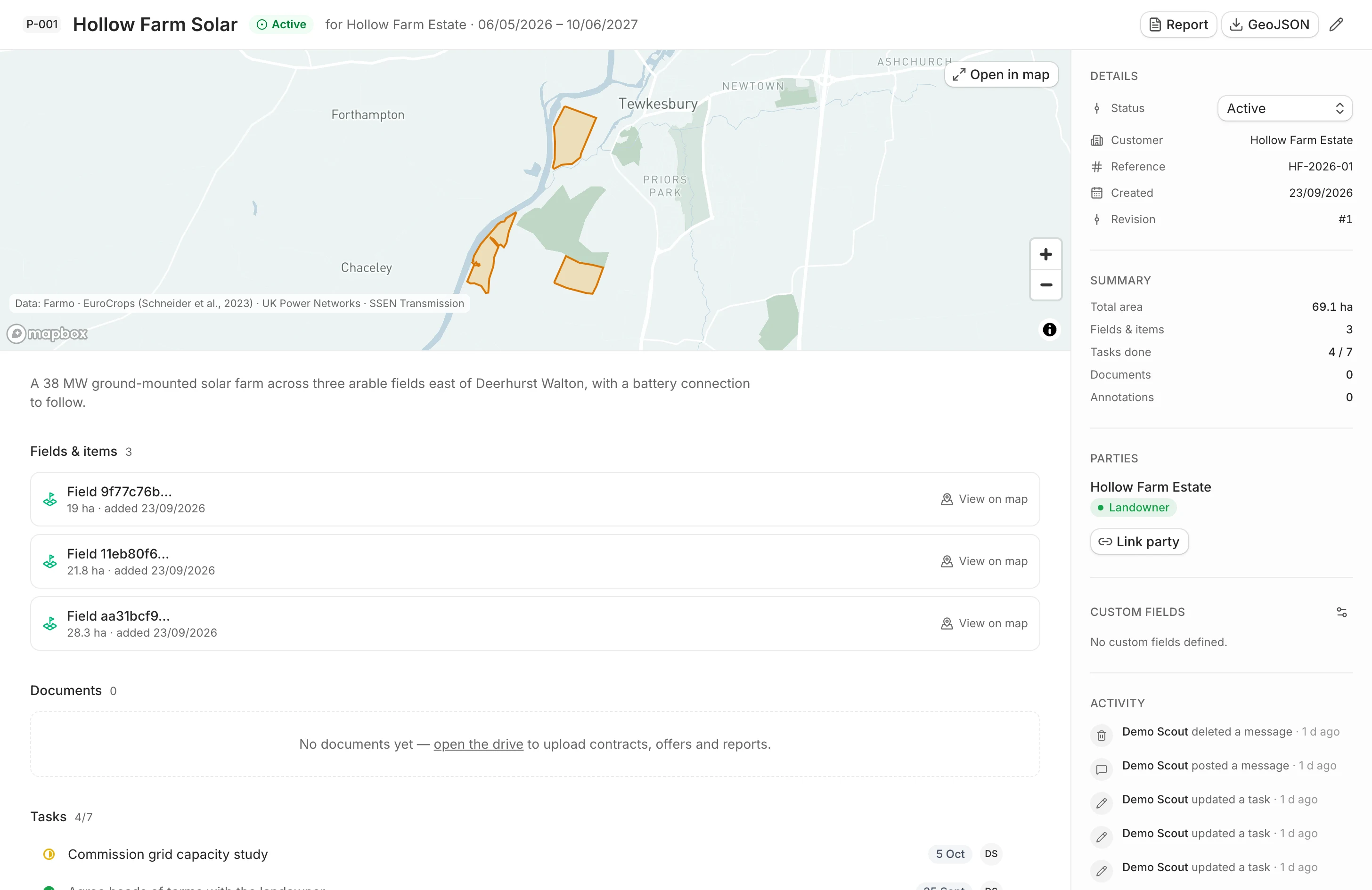
Tasks, discussions, documents and the people involved sit on the same map as the fields they concern — so nothing about a site lives in someone’s inbox.
Tasks, down to the last detail.
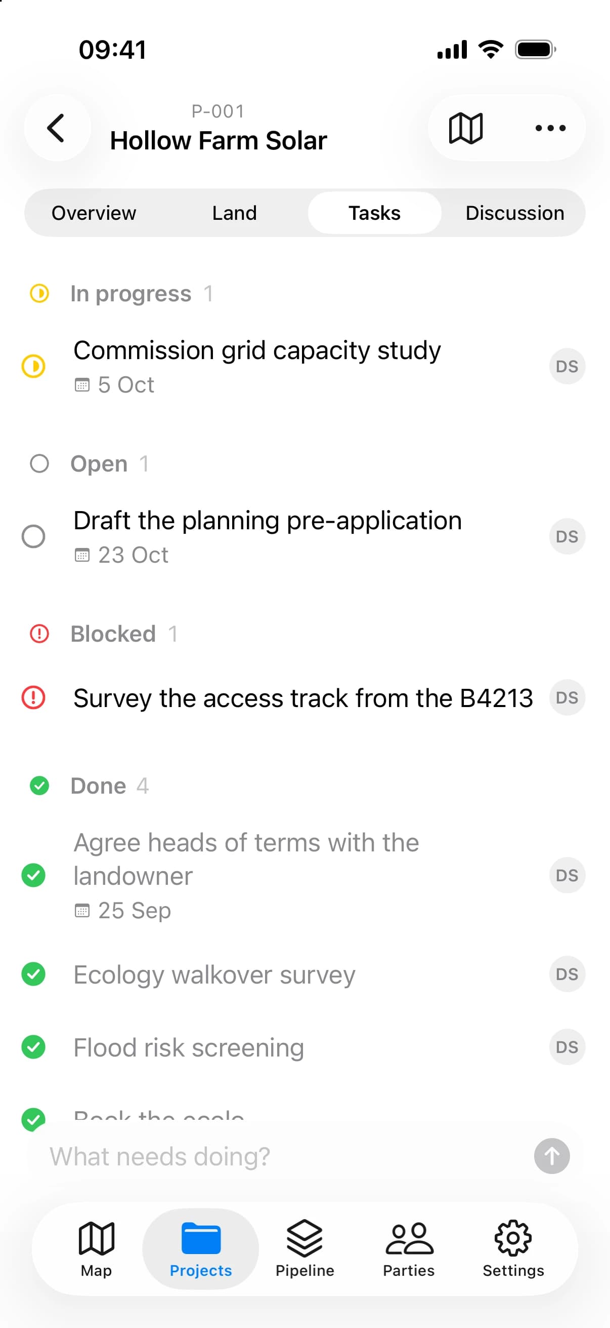
Subtasks, owners, due dates and a status each — open, in progress, blocked or done — grouped so the stuck ones stand out.
The conversation, where the work is.
Every task has its own discussion, so a decision stays with the thing it decided.
Documents, in every version.
Contracts, offers and surveys keep each version they have been through, beside the project they belong to.
The land, attached.
Fields, sites, pins, photos and drawings belong to the project, and open on the map in a tap.
Everyone involved.
Landowners, agents and consultants are kept as parties, linked to the projects and fields they concern.
Your own fields.
Add the references, figures and dates your team works by to projects and tasks, as fields of your own.
Nothing is
ever overwritten.
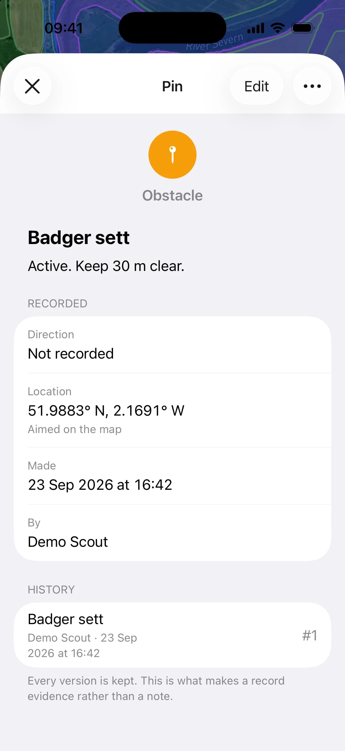
LandAreas keeps every version of everything, so what was recorded, by whom and when can always be shown — to a landowner, a planning officer or an investor.
Every change is a new version.
Editing a record, a task or a project adds a revision. The one before it stays, exactly as it was.
Deleting leaves a trace.
What is removed is marked as removed, not erased, so the history stays whole.
Documents with a fingerprint.
Every version of a file is stored with a hash of its contents: evidence that it has not changed since.
Who, what and when.
Every project shows its activity — who changed what, and when — for the whole team to see.
Roles, enforced by the platform.
What each person may do is decided on the server, not by the app in their hand.
Nothing lost in between.
A change made without signal is written exactly once when it arrives, however patchy the connection on the way.
Bring in the right people.
Only as far as they need.
Your team.
Invite colleagues with a link, as owners, admins or members — each able to do what their role allows, and nothing more.
Your partners.
Bring landowners, agents and consultants into just the part of a project that concerns them — its fields, its tasks, its documents — and nothing beyond it.
Everyone else.
Send a printable project report, export boundaries as GeoJSON for any GIS, and hand over documents as they stand.
The land is out there.
Find it first.
- In the browser
- For iPhone
- For Android